


Missouri may not have palm-lined beaches, snowcapped mountains, or a Grand Canyon. But we certainly have our share of jaw-dropping scenery. From deep blue springs where water magically bubbles out of the bedrock to waterfalls that crash down the side of Ozark cliffs, Missouri’s wildest nooks and crannies will make you wonder if you’re really in the Midwest. But don’t take our word for it. Check out these postcards that showcase the Show-Me State in its most spectacular state.
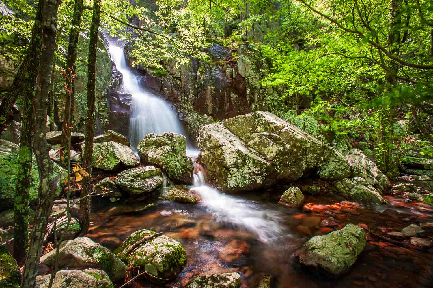
Castor River Shut-Ins
37.56888° N, 90.15506° W
In Madison County, about 10 miles east of Fredericktown.
In the northwest corner of Amidon Memorial Conservation Area, the cool, clear waters of the Castor River swirl around massive granite boulders, cascade over mini waterfalls, and churn inside deep potholes. Over millions of years, the rushing river — along with the sand and gravel that it carried — scoured away the softer rock that it once flowed over. Harder, more-resistant granite didn’t wear away as quickly, and over time the river became “shut in” to a narrow, canyon-like valley.
Bucket List > You don’t have to snorkel a coral reef to find flashy fish. Strap on a diving mask and peer into the quiet pools downstream from the shut-ins. You’ll see schools of Ozark minnows, bleeding shiners, and rainbow darters.

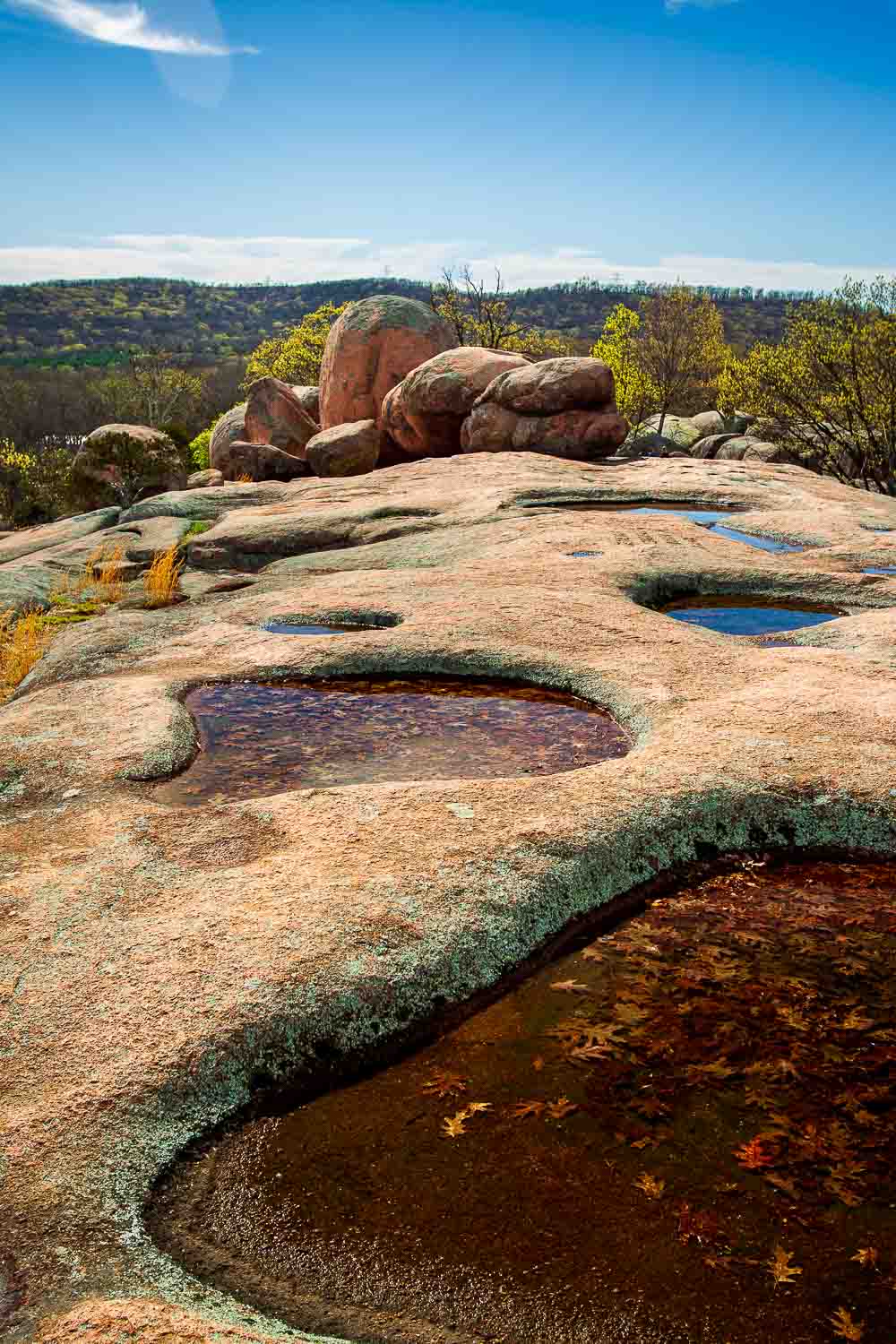
Elephant Rocks State Park
37.65243° N, 90.68935° W
In Iron County, about 4 miles north of Pilot Knob.
Like a parade of circus elephants, the enormous granite boulders at Elephant Rocks State Park seem to march across the rugged Ozark landscape. The largest of the rocks — nicknamed “Dumbo” — stands 27 feet tall and tips the scales at over a million pounds. The supersized stones were formed 1.5 billion years ago when hot, liquid rock, called magma, bubbled up into the Earth’s crust and cooled. Over millions of years, erosion sanded the granite into the round shapes you see today.
Bucket List > Channel your inner monkey and scramble to the top of an “elephant.” Bouldering — rock climbing without a rope — is allowed at Elephant Rocks, but never climb higher than you can safely fall.
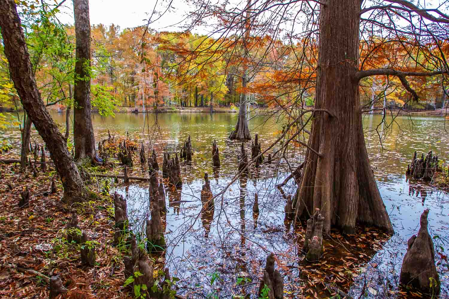
Mingo National Wildlife Refuge
36.96927° N, 90.15166° W
In Stoddard and Wayne counties, about 2 miles north of Puxico.
Although you won’t find any alligators lurking at Mingo National Wildlife Refuge, the soggy, cypress-speckled swamps are home to turtles, frogs, snakes, and all kinds of other water-loving critters. In the spring and fall, thousands of ducks and geese make pit stops at Mingo to rest and refuel during their long migrations. Pick up a map from the visitor center (open Wednesday and Friday, 10 a.m. to 4 p.m.), then take a hike or embark on the 17-mile drive around the 21,000-acre area.
Bucket List > One of the best ways to experience the swamp is in a canoe or kayak. Paddle the refuge’s water trail in late September when cypress trees turn rusty red with fall color.
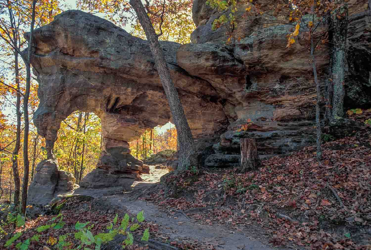
Pickle Springs Natural Area
37.80140° N, 90.30179° W
In Ste. Genevieve County, about 7 miles east of Farmington.
The best time to visit Pickle Springs is in the fall, after it rains. On the Trail Through Time you’ll hike past Cauliflower Rock, through the Keyhole, and see arches and “hoodoos,” pillars of sandstone weathered into unusual shapes. Trickling water provides a soundtrack for your walk, as small waterfalls drip and splash into fern-lined fairy pools. About halfway through the 2-mile loop, the trail emerges from a stand of shortleaf pines, and you’ll be rewarded with a bluff-top view of oaks and hickories ablaze with fall color.
Bucket List > Keep your eyes open for Ice Age animals and plants, like four-toed salamanders and hay-scented ferns. These species were more common thousands of years ago when Missouri’s climate was cold and wet.
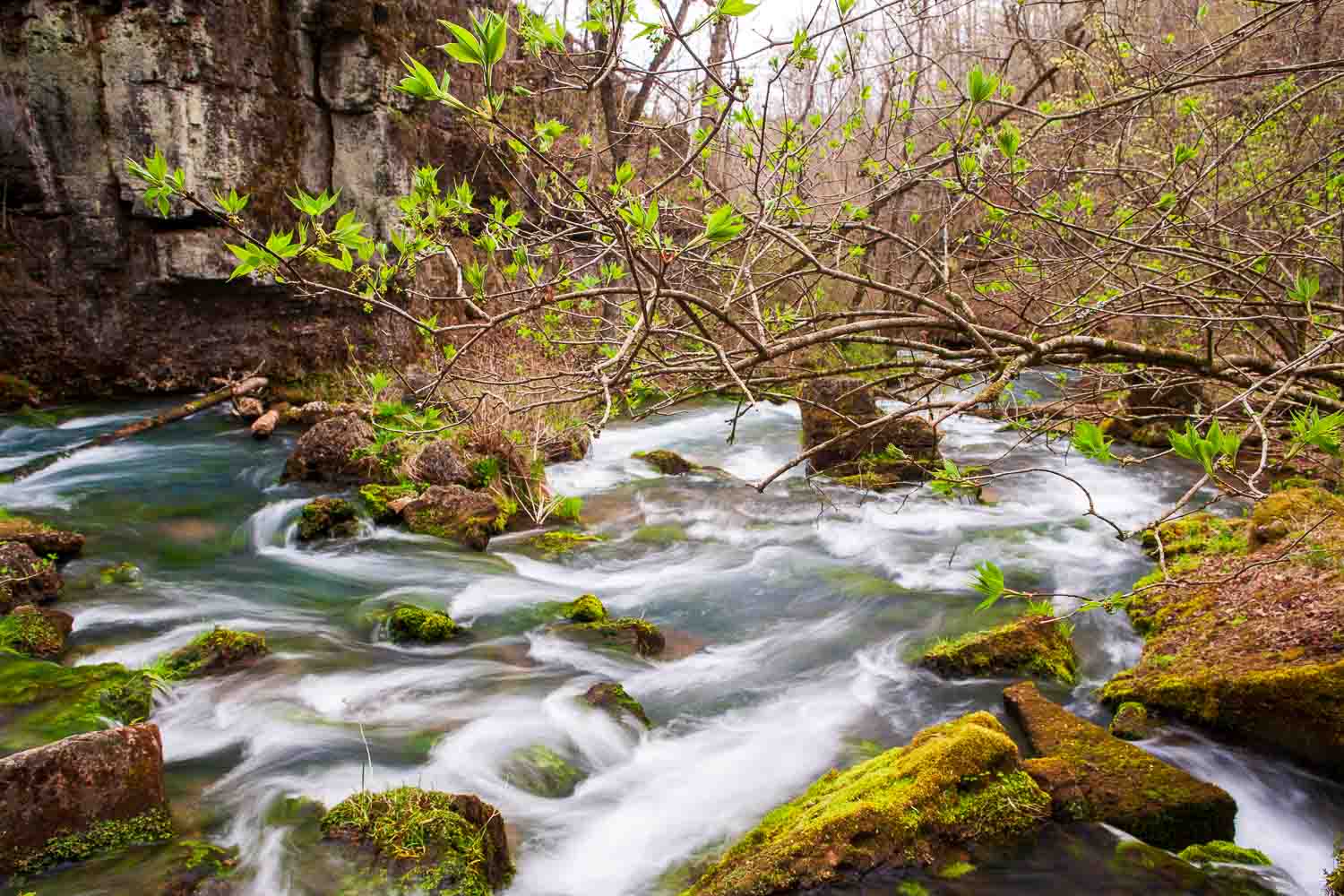
Greer Spring
36.77964° N, 91.34535° W
In Oregon County, about 8 miles north of Alton.
On an average day at Missouri’s second largest spring, over 200 million gallons of cold, clear water bubble up from the bedrock and tumble down a mile-long, rock-strewn chute into the Eleven Point River. On a hot day, fog rises off of the bone-chilling water, cloaking the fern-lined valley in mist. A shady but rugged 1-mile trail leads from the parking lot downhill to the spring.
Bucket List > Although no swimming, wading, fishing, or boating is allowed in the spring channel, the nearby Eleven Point River is a great place to hook a smallmouth bass or rainbow trout.
Mina Sauk Falls
37.56265° N, 90.73990° W
In Iron County, about 10 miles west of Ironton.
Mina Sauk Falls is the tallest waterfall in Missouri. From the rocky ledge at the top, water plunges over the side of a steep cliff to crash and splash into Taum Sauk Creek, 132 feet below. While this sounds impressive — and it is — during dry weather the falls slow to a trickle, so be sure to visit after a good rain. The 3-mile Mina Sauk Falls Trail at Taum Sauk State Park loops from a parking lot to the waterfall. The trail is steep and rugged, so wear sturdy shoes and pack plenty of water.
Bucket List > On your way to the falls, stop for a photo at the rooftop of Missouri. Taum Sauk Mountain’s summit, at 1,772 feet above sea level, is the tallest point in the Show-Me State.
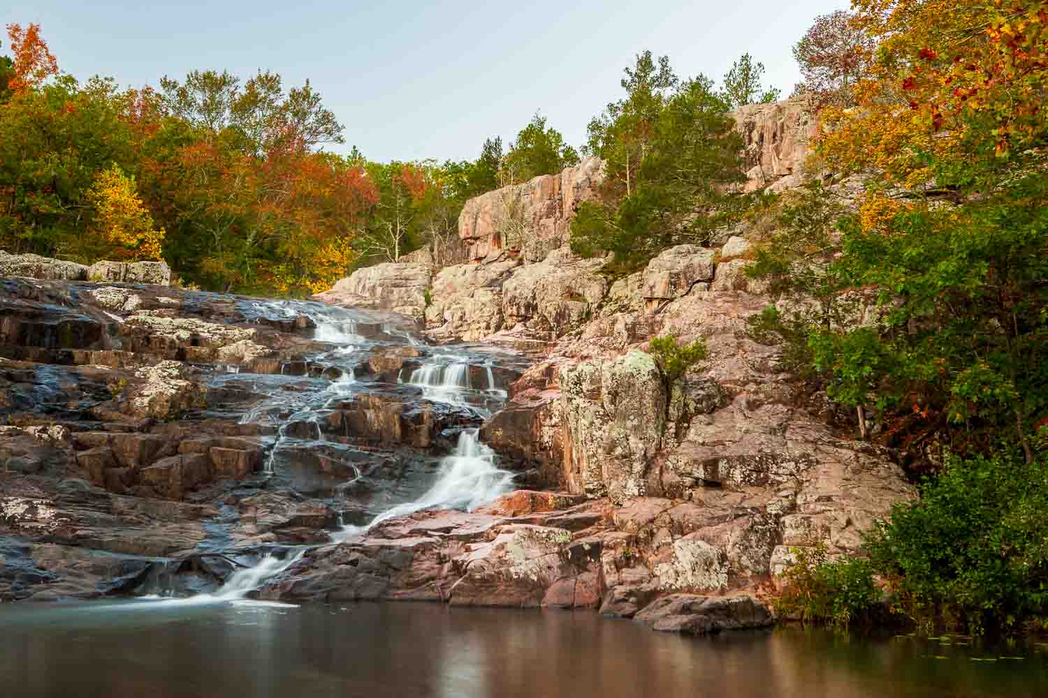
Rocky Falls
37.09492° N, 91.21023° W
In Shannon County, about 9 miles southeast of Eminence.
At Rocky Falls, the water of Rocky Creek takes a rollercoaster ride over a series of pink rock ledges to splash into a pool 40 feet below. The falls, which run best after a good rain, are part of the National Park Service’s Ozark Scenic Riverways. The short trail from the parking lot to the falls intersects the Ozark Trail, a 400-mile path that stretches from St. Louis to Arkansas, passing through some of the prettiest, wildest, and most rugged parts of Missouri along the way.
Bucket List > Pack your swimsuit. At the base of the falls, a refreshing swimming hole offers a scenic spot to cool off on a hot summer day.
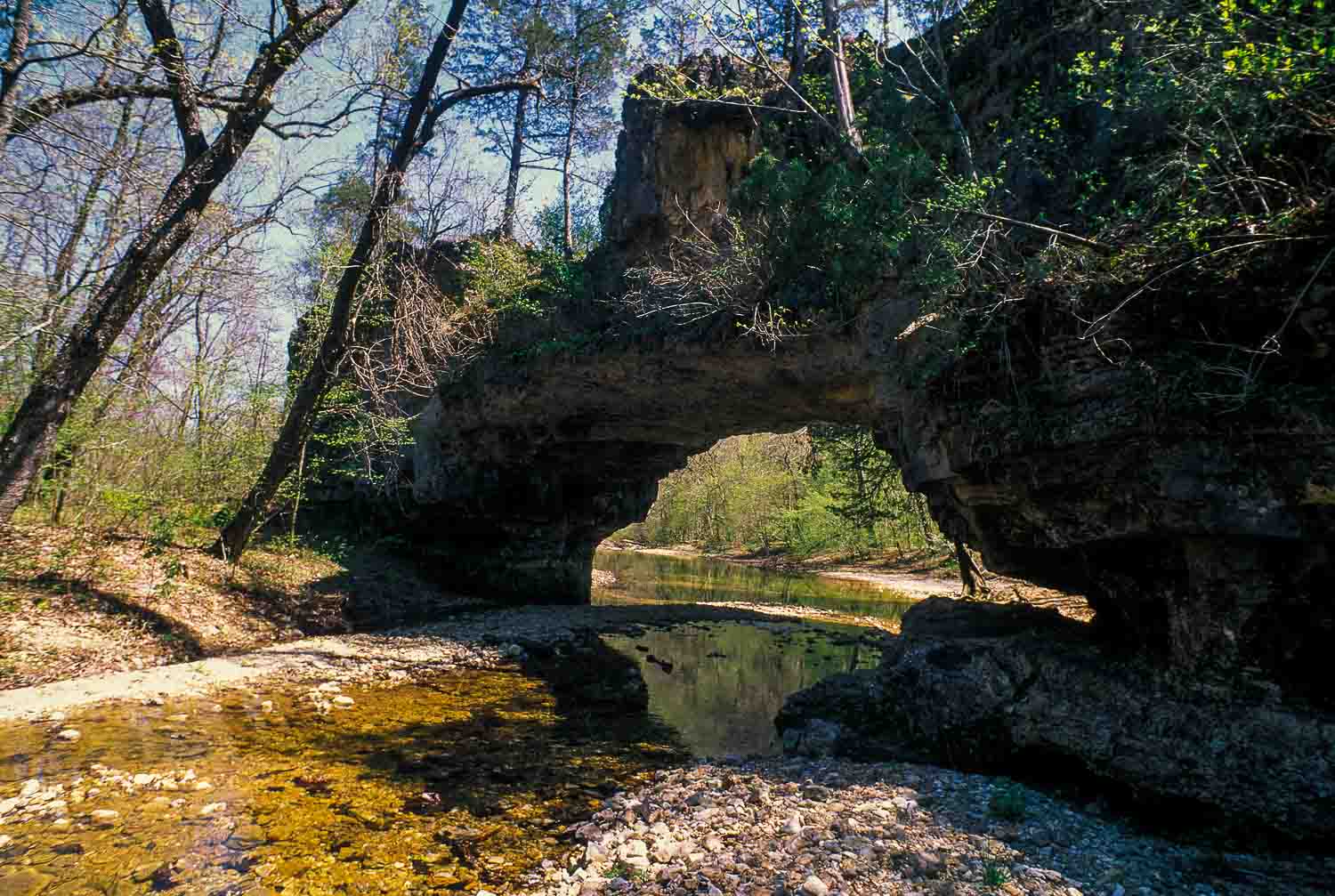
Clifty Creek Natural Area
38.03055° N, 91.98183° W
In Maries County, about 8 miles east of Dixon.
A short but rugged hike from the parking lot at Clifty Creek Natural Area will lead you to one of Missouri’s most impressive geologic wonders. Spanning across the clear waters of the creek is a 40-foot-long bridge of rock that wouldn’t look out of place in the Desert Southwest. The bridge was formed when a tributary of Clifty Creek took a shortcut through a crack in a steep ridge of rock. Over time, the water eroded the rock into the arch you see today.
Bucket List > Pack a field guide! More than 450 different kinds of plants have been found at Clifty Creek. How many can you spot?


Also In This Issue

They’re big. They’re hairy. But are they really scary?
And More...
This Issue's Staff
Photographer – Noppadol Paothong
Photographer – David Stonner
Designer – Marci Porter
Art Director – Ben Nickelson
Editor – Matt Seek
Subscriptions – Marcia Hale
Magazine Manager – Stephanie Thurber