


Fountain Grove Conservation Area sits in the floodplain of the Grand River and serves as an important migration stop for a variety of wildlife. It also plays an essential role in providing winte
Media

Safety Concerns
Name
Skin irritating
Scientific Name
Persicaria amphibia (formerly Polygonum amphibium)
Family
Polygonaceae (knotweeds, smartweeds, buckwheats)
Description
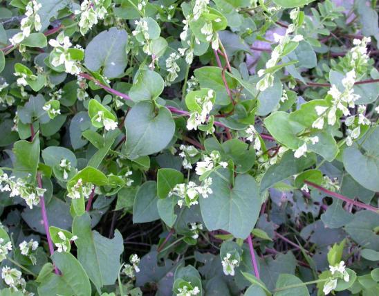
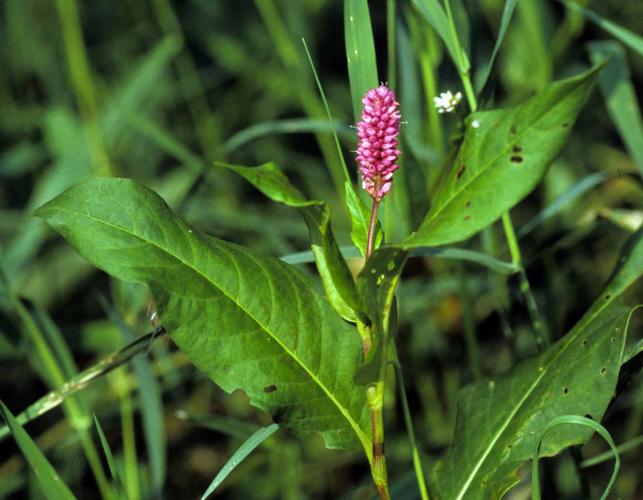
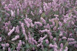
Water smartweed is a terrestrial or aquatic perennial often forming dense colonies covering large areas. Stems erect, branching, often sprawling as they grow, taking root at the swollen nodes. Flowers in long, erect racemes, rich pink, rarely white, showy. Blooms June–October. Leaves alternate, ovate, sharply pointed, on petioles (leaf stems).
Similar species: There are some 15 other smartweeds (in the genus Persicaria) recorded for our state. If the more traditional taxonomic groupings are used, then there are nearly 30 relatives (smartweeds and knotweeds, in the genus Polygonum) recorded for our state.
Size
Length: stems to about 40 inches.
Where To Find

Occurs statewide except some Ozark counties.
Habitat and Conservation
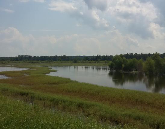
Found in any wet, open land, streamsides, shores of lakes, ponds, and sloughs. This is an amphibious plant that can live submerged in water, or on wet banks or other soggy ground, yet can also live in merely moist areas. Plants growing underwater tend to be hairless, while those growing out of water often have hairs on stems or leaves.
Status
This plant was, for a long time, included into a very large genus Polygonum. Many botanists have decided to break up that group into separate genera. Water smartweed and its close relatives were segregated into the genus Persicaria, in part, because of their shared characteristic of having spikelike flower clusters.
Human Connections
This and other smartweeds were used medicinally and as food by various Native American tribes. Note that handling some species of smartweed can sometimes cause a skin rash in sensitive individuals. To gardeners, smartweeds are often considered a nuisance.
Ecosystem Connections
Smartweeds are related to buckwheat, and their nutritious nutlets are an important food for aquatic waterfowl, songbirds, quail, doves, and small mammals. Land managers often encourage our native smartweeds in wetlands as wildlife food as well as to hold soil and purify water.
Title
Media Gallery
Image
Caption
Water smartweed can live submerged in water, or on wet banks or other soggy ground, yet it can also live in merely moist areas. The stems often sprawl as they grow, taking root at the swollen nodes. The small, pink flowers develop in long, erect clusters.
Credit
Ohio State Weed Lab Archive, The Ohio State University, Bugwood.org
Right to Use
Use of this image is restricted to MDC only
Image

Credit
Photo by MDC Staff, courtesy Missouri Department of Conservation.
Right to Use
Use of this image is restricted to MDC only
Image

Image
Title
Similar Species
Similar Species
Where to See Species

When early explorers were making their way across what would be southeastern Missouri, they saw a seemingly endless expanse of bottomland hardwood timber and an interconnecting complex of sloughs and

B.K. Leach Memorial Conservation Area is in northeastern Lincoln County.
This 1,343-acre area is bounded on the south by the Missouri River, on the east by Moniteau Creek, on the north by the Katy Trail, and on the west by a levee.
About Wildflowers, Grasses and Other Nonwoody Plants in Missouri
A very simple way of thinking about the green world is to divide the vascular plants into two groups: woody and nonwoody (or herbaceous). But this is an artificial division; many plant families include some species that are woody and some that are not. The diversity of nonwoody vascular plants is staggering! Think of all the ferns, grasses, sedges, lilies, peas, sunflowers, nightshades, milkweeds, mustards, mints, and mallows — weeds and wildflowers — and many more!