Xplor reconnects kids to nature and helps them find adventure in their own backyard. Free to residents of Missouri.


Stay in Touch with MDC news, newsletters, events, and manage your subscription

Xplor reconnects kids to nature and helps them find adventure in their own backyard. Free to residents of Missouri.

A monthly publication about conservation in Missouri. Started in 1938, the printed magazine is free to residents of Missouri.


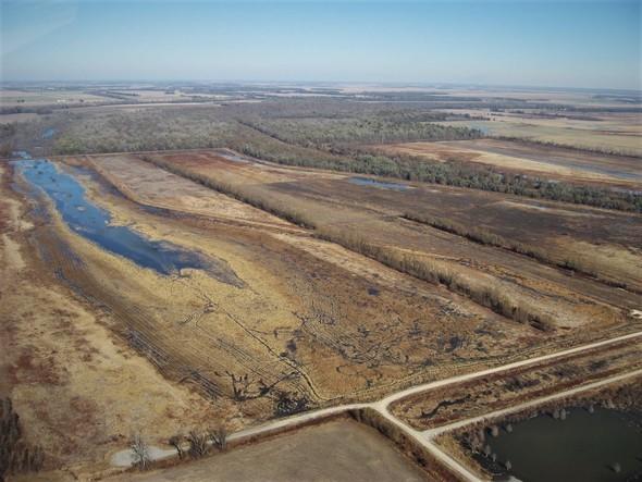
EAST PRAIRIE, Mo. – The Missouri Department of Conservation (MDC) is working on several solutions for improving low water levels at Ten Mile Pond Conservation Area (CA) in Mississippi County.
“The river coming from historic lows, extreme drought conditions, and wells being down across the area, are making it hard for area staff to flood parts of the conservation area,” said MDC Mississippi Lowlands East District Supervisor Tim Kavan. “Typically, three wells work in unison to help flood the entire west side of Ten Mile Pond CA. Two of the three wells have cracked screens and pump sand into the units when powered on, causing this aging infrastructure to fail.”
He said staff at Ten Mile Pond CA have taken a proactive approach with the management of natural resources to best accommodate the public use on the area.
These new management approaches include:
Kavan said fall and winter rains could quickly improve wetland conditions, especially those with good growth of natural waterfowl foods through the summer.
Because of the topography and soil types of Ten Mile Pond CA, he said flooding certain parts of the area can be quite difficult when the Mississippi River is low and the area experiencing drought conditions.
“When the river is high, it allows staff to back fill some of the wetland pools from Ten Mile Pond ditch, which are fed by the Mississippi River,” said Kavan. “The river being up also brings the water table and saturation levels of the soil up, which in turn, allows for area staff to flood wetland units easier.”
Kavan added he’s grateful that MDC staff don’t have to completely rely on Mother Nature to create opportunities for waterfowl hunters in southeast Missouri.
MDC recommends waterfowl hunters scout wetland conditions and gather other area information beforehand by calling (573) 649-9491.
Find out more about Ten Mile Pond Conservation Area online at https://mdc.mo.gov/discover-nature/places/ten-mile-pond-conservation-area.