


Growing up in Jefferson City, I used to envy people who lived in the Ozarks. They have all those terrific float streams right outside their back doors. That was before I floated the Missouri River and discovered that one of the Show-Me State's premier float streams has been outside my back door all along.
Once I found out what I had been missing, I was eager to share it with friends, so I organized a two-day float trip. Like Meriwether Lewis & William Clark, who floated the river nearly 200 years ago, I kept a journal. Take a few minutes to relive the trip with us. If you're like most of the 2.8 million Missourians who live in counties adjoining our state's namesake river, you'll be surprised at what we found.
August 25 - 10:30 a.m.
A light drizzle is falling as I peer downstream from the Carl R. Noren Public Fishing Access, within sight of the State Capitol. Despite a temperature in the mid-60s, the air feels steamy.
I can barely see the last of our six canoes, which launched a few minutes earlier. They took off while John and I were driving back from Hermann, where we left two minivans and the canoe trailer. It's time to get on the water ourselves.
John, his daughter, Katherine, and I shove our boats into the current and start our motors. We are bringing up the rear for our party to lend a hand if needed and make sure no one falls too far behind. Besides John and 9-year-old Katherine, we have another father-daughter pair, Rick and Jenny, who is a recent college graduate. We also have two father-son pairs, Jim and Josh, a high school senior, and Dennis and Miles, age 10.
Two other canoeing teams - Joan and Martha, and Janet and Joe - are office friends. Rounding out our party of 16 is a pair of sisters, Carolyn and Tracy, plus Dan, who is leading the party in a motorized john boat. My boat mate is a golden retriever named Guiness.
Two and a half hours ago (our planned departure time), a sodden rain was dimpling the river's surface. We waited because the weather forecast said the rain was moving out. We didn't want to paddle 29 miles and cook our meals in a downpour.
11:30 a.m.
The worst thing about our late start is that it leaves us no time to explore Clark's Hill. The Lewis and Clark expedition stopped at this rock outcrop near the mouth of the Osage River to make celestial observations and measure the width of the two rivers. Elegantly carved initials, believed by some to be those of two expedition members, still can be seen at the base of the bluff.
Noon
From the shore of Smoky Waters Conservation Area, not far from the historic site, two campers wave to us from the door of a green and purple tent.
Clouds are fading, and with them my worries fade, too. Everyone is in high spirits. The inch or so of rain that fell last night won't raise the water level enough to encroach on our intended campsite. Things are going to be OK. I have cut the engine and am drifting, absorbing the majesty of river bluffs and valleys that Lewis might have described as "a beautiful prospect."
12:45 p.m.
My boat is tracing lazy, drifting circles in the current. Guiness is having the time of her life swimming after a great blue heron that took off from a wing dike as we floated past.
Everyone seems content as we drift downstream, occasionally using paddles or motors to maneuver or add speed to the 3- or 4-mile-per-hour current of the main channel.
1 p.m.
A pair of sleek, long-beaked birds with black-and-white plumage just cruised past. Several of us wondered if they could be interior least terns, an endangered species that nests on sand bars. Jim, our resident bird expert, says they are Forester's terns.
So far, we have seen no sign of the barges for which the Corps of Engineers has narrowed and straightened the river, creating a 9-foot deep navigation channel.
2 p.m.
We have pulled up on a mud bank to stretch our legs and eat sandwiches for lunch. We're about 12 miles downstream from our starting point, still 17 miles from our evening campsite. We are ready to relax. It's nice in the shade, and we linger, sharing the morning's experiences.
3:30 p.m.
Still no sign of barges, but we're seeing lots of recreational boats. We were all amazed when three big, Miami Vice-style speedboats hurtled past a few minutes ago.
Besides the cigarette boats, we have seen a pontoon house boat, a couple of fishing boats and a number of people in different motor boats sightseeing. A jug-line fishing tournament is under way. Last weekend, this stretch of the river hosted a catfishing tournament. So ends our fantasy of exploring an "undiscovered" river. Still it's reassuring to know that others are around if we need help.
The river looks full enough, but one of the experienced "river rats" says it is flowing at a piddling 41,300 cubic feet per second (cfs) at Kansas City. That means that about 18 million gallons of water are rolling past Kansas City every minute.
This is about the same level as wildlife advocates would like to see once every few summers to ensure good nesting spots for the least tern. Periodic low flows like this also benefit other wildlife, not to mention people who like to float the river.
4:15 p.m.
Cicadas are serenading us from both banks with hypnotic effect. Miles has kicked back for a siesta. Dan is performing cannonballs off the front deck of his johnboat to stay awake. This is fun, but we are running behind. I start my motor to run downriver and check our camp site.
4:45 p.m.
Rounding the bottom end of the island across from the Conservation Department's Portland Access, I turn up a side channel separating the island from the south bank. Five blue-winged teal take flight. Everything is perfect at the campsite. The sandy beach is four or five feet above water and has driftwood for a fire. I head back upstream to deliver the news and rally the troops.
5:15 p.m.
Our late start and my ambitious mileage goal have meant too much paddling and too little play for those in canoes. I sense some grumbling from members of our modern day Corps of Discovery when I announce that we still have four or five miles to go.
6:30 p.m.
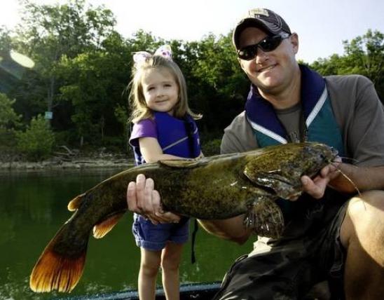
Our home for the night is a 15-acre island cradled in a lazy, six-mile river bend. Once the canoes landed, it was every camper for her or himself. Martha and Joan are lounging on the sand. Tracy and Carolyn are off beach combing. Dan brought out fishing poles and began baiting hooks for Miles and Katherine, who now are hauling in channel catfish. Others are washing off sunscreen and sweat in the gentle current of the side channel. Cold drinks and supper fixings are starting to appear.
Josh and Jim are exploring the complex of low sand bars between the island and the main channel. Ankle- to waist-deep water meanders among the bars, creating the sort of braided channel that once occupied most of the river's 1- to 2-mile-wide valley.
8 p.m.
Cook fires are burning and a feast is taking shape. Everyone brought more food than they need, and the meal has turned into a drawn-out potluck featuring grilled steaks, boiled jumbo shrimp, seafood jambalaya, chili mac, bratwurst and, of course, catfish. Dessert is Dutch oven cinnamon rolls.
As the fire burns down to coals, we talk about the day. We generally agree that a shorter float would have been less taxing and allowed time for more river fun.
10 p.m.
A torrential shower chases everyone into their tents. The storm lasted only 20 minutes or so, but by then the drone of rain had been replaced by the drone of snoring. Dan and I decide to fish for awhile, and the campfire recaptures a few night owls. Their voices seem loud against the hushed gurgle of the river. The stars, peeking through the parting clouds, are uncommonly vivid in a jet black sky.
Sunday - 7 a.m.
Laughter filters through the tent walls. I hear the hiss of a camp stove. I smell coffee. Someone is cooking breakfast.
Guiness, who apparently has been up for some time, is sitting by the tent door, staring at me. I let her out to do her business and mooch tidbits from the breakfast crowd.
8:30 a.m.
I grab a breakfast bar and head for the campfire. Conversation revolves around today's float. Sixteen miles separate us and Hermann, our takeout point. "No sweat," I think. Then I remember that not everyone has a 6-horsepower helper.
9 a.m.
A towboat - the first we have seen - slips downriver. The throbbing of its engines is so deep we feel it more than hear it. It is pushing a modest flotilla of three barges. One floats high in the water, obviously empty.
9:30 a.m.
Most of the canoes are headed downstream, but a few linger to enjoy the cool morning breeze and see what "Old Man River" has washed up at the head of the island. They turn up bits of obsidian, flint flakes from Indian tool-making, a dozen chunks of petrified wood and an odd smattering of other fossils. One, an arm or leg bone of some medium-sized animal, is perfectly preserved, glossy black and heavy as stone.
10:30 a.m.
We are all back on the water again, making for our takeout point with gusto. Everyone wants to get off the water before the sunny day turns hot and humid. Also, Hermann's many fine restaurants and vineyards beckon.
12:30 p.m.
Lunch break on a big sandbar opposite the mouth of the Gasconade River. The biggest difference between yesterday and today is the increased number of people we are seeing. We've hardly been out of sight of boats since shoving off. Thirty or 40 are beached here, and folks are playing with Frisbees and beach balls, sunbathing and building sand castles, picnicking and lounging in lawn furniture. Jet skis buzz around like huge water striders, churning up waves on the normally flat river. The surface chop cancels out the benefit of the river's current and splashes over the bows of some of our canoes.
2 p.m.
Here comes the second barge of the trip, this one headed upstream. We are in a bend in the river, and since the navigation channel always follows the outsides of bends, our flotilla hugs the inside. The swells kicked up by tow boats are big, but by the time they reach us they don't present any hazard. Our canoes bob like corks.
2:30 p.m.
We spy the Highway 19 bridge. We will be in Hermann in less than an hour. A persistent breeze provides some relief from the sweltering heat.
4:15 p.m.
Canoes loaded and gear stowed. Time for a cold drink and a hot meal at a local eatery.
Except for being a tad long, it was an extremely enjoyable trip. Up close, the river seems both grander and friendlier than most of us imagined. Jim and Josh enjoyed it so much they already are planning a return trip with their Explorer Scout post. Carolyn is looking forward to having an archaeologist identify her fossil bone, and most of us have pieces of driftwood or some other souvenir of our two days on "The Big Muddy." triangle
How far would you go to float the Big Muddy?
If you doubt that the Missouri River is a world-class float stream, ask Richard Ryan. Last year he floated from Montana to the mouth of the Missouri River in a touring kayak he built from a kit. Ryan, 47, is a real-estate entrepreneur from Middlesex, Great Britain.
"I can't believe how few people I've seen on the river," he said. "The scenery is incredible, and there are so many lovely campsites. It's amazing more people don't come here."
Rules of the Road
- Always wear a life jacket when canoeing or boating.
- Leave word with friends or family about where you will be floating and when you should return.
- To stay in the main channel, keep the black "can" buoys on your right going downriver and on your left going upriver. The opposite is true for red "nun" buoys.
- Head upstream when landing. Having a swift current at your back makes landing tricky.
- Stay well away from barges. Until you take the measure of these behemoths, it's best to cross to the opposite side of the river when you see them coming.
- Approach wakes from tow boats and other motorized craft head-on. One of the few ways to swamp a canoe on the Missouri River is to let a wave roll into you broadside.
- Stay alert. The flat expanse of the river can lull you into carelessness. If you aren't paying attention, you can T-bone one of the navigation buoys while drifting in the current.
- Watch for turbulent water that marks the location of rock just beneath the surface. These aren't much of a hazard to canoes, but they can damage larger boats and motors.
- If your boat swamps, don't leave the boat and try to swim to shore. Instead, hold onto the boat and "swim" it to safety.
- Avoid floating during high water, when the river washes out logs and other debris that make navigation dangerous.
- The U.S. Coast Guard river boating safety booklet, "Rules of the Road," can be downloaded online. Or, you can order a copy from Superintendent of Documents, U.S. Government Printing Office, Washington, D.C. 20402.
Floating tips
- Bring a motor boat. One of the boats in your flotilla should be able to go upriver if necessary.
- Don't bite off too much mileage. Err on the short side - 10 or 15 miles per day - so you can stop often to explore.
- Find campsites beforehand. Islands and sandbars are widely spaced in some river stretches, so you need to scout them in advance.
- Don't count on cell phones. Reception is spotty at best and nonexistent in many reaches of the river. Carrying walkie-talkies in the front and back canoes is a good way of keeping in touch with fellow floaters.
- Go with the flow. When you want make time, stay in the main navigation channel. The brisk current will multiply your paddling power.
- Put some weight up front. Keeping a boat pointed down river with a headwind is less tiring if you keep your bow low in the water.
MO Floats
More than 40 conservation areas and public accesses with boat ramps are available to put in and take out of the Missouri River from the Iowa state line to the mouth of the river. These and other public areas along the river are listed in "Upper Missouri River," "Middle Missouri River" and "Lower Missouri River." These brochures are available at Conservation Department district offices statewide.
- Watson Access to Langdon Bend Access in Atchison County - 12 miles
- Landgon Bend Access to H.F. Turnau Conservation Area in Holt County - 22 miles.
- H.F. Thurnau Conservation Area to the boat ramp at White Cloud, Kan. - 21 miles
- Payne Landing Access in Holt County to Nodaway Island Access in Andrew County - 9 miles
- Nodaway Island Access in Andrew County to French Bottom Access in St. Joseph - 12 miles
- French Bottoms Access to Jentell Brees Access - 13 miles
- Marion Access in Cole County to Carl R.Noren Access at Jefferson city - 14 miles
- Carl R. Noren Access to Portland Access - 29 miles
- Chamois Access to Gasconade Park Access - 14 miles
- Hermann Boat Ramp to New Haven Boat Ramp - 16 miles
- Washington City Boat Ramp to Weldon Springs Access - 20 miles
- Weldon Spring Conservation Area in St. Charles County to Blanchette Landing Access at St. Charles - 25 miles.
- Blanchette Access to the mouth of the river at Columbia Bottom Conservation Area - 27 miles.
And More...
This Issue's Staff
Managing Editor - Bryan Hendricks
Art Editor - Dickson Stauffer
Artist - Dave Besenger
Artist - Mark Raithel
Photographer - Jim Rathert
Photographer - Cliff White
Staff Writer - Jim Low
Staff Writer - Joan McKee
Circulation - Bertha Bainer